What is Magnetotellurics (MT)?
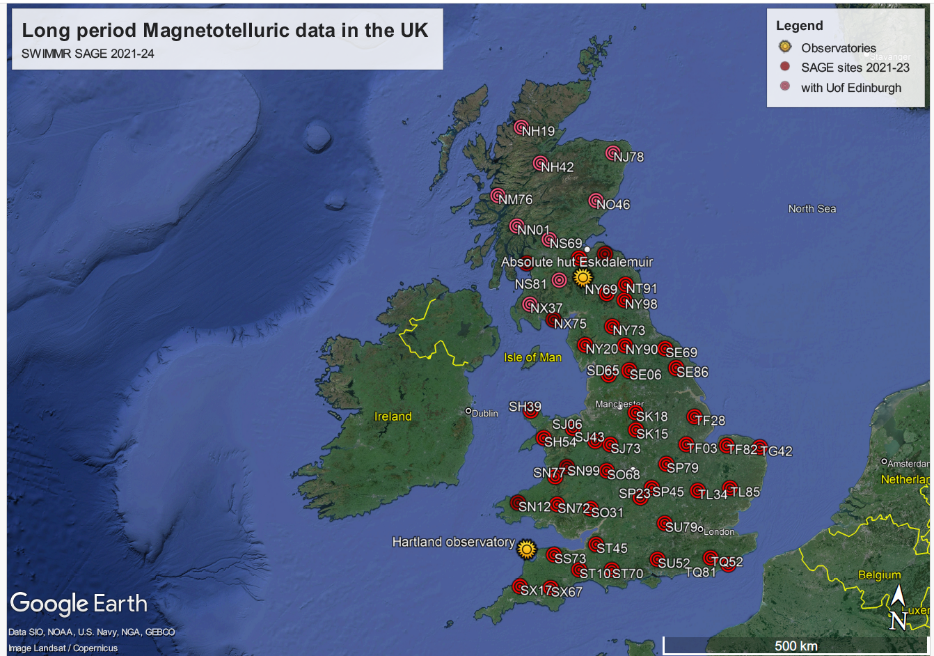
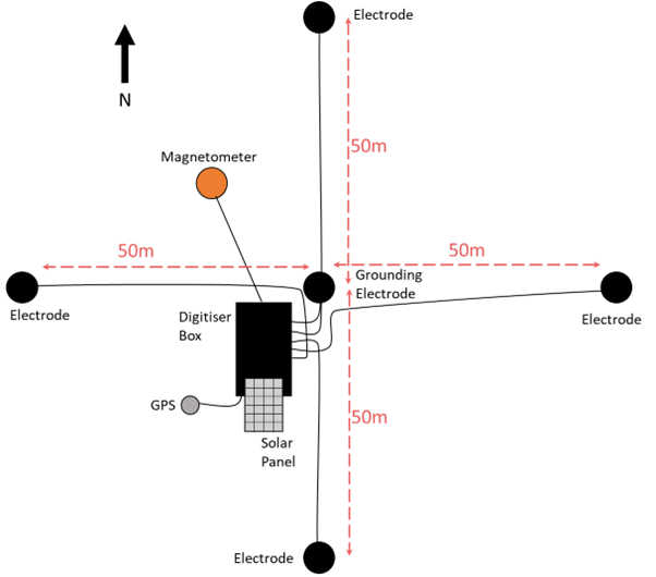
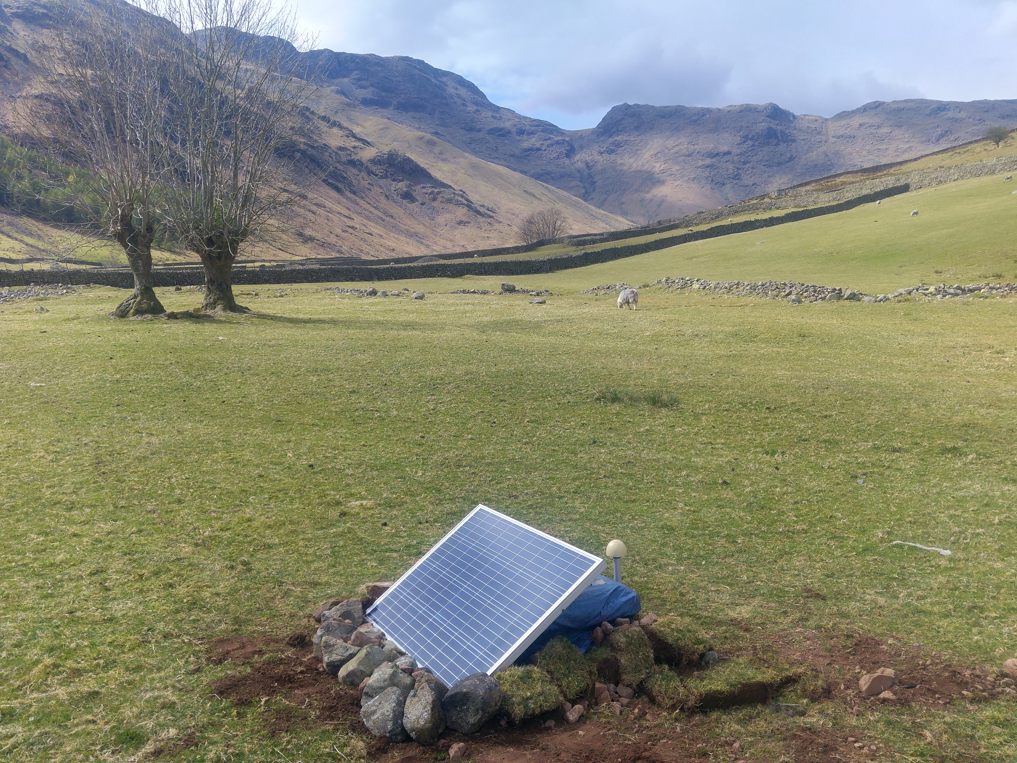
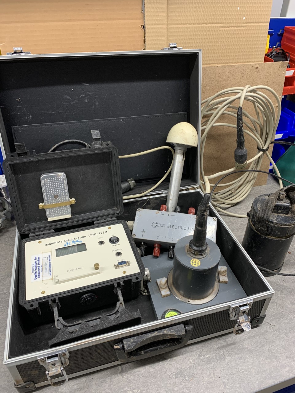
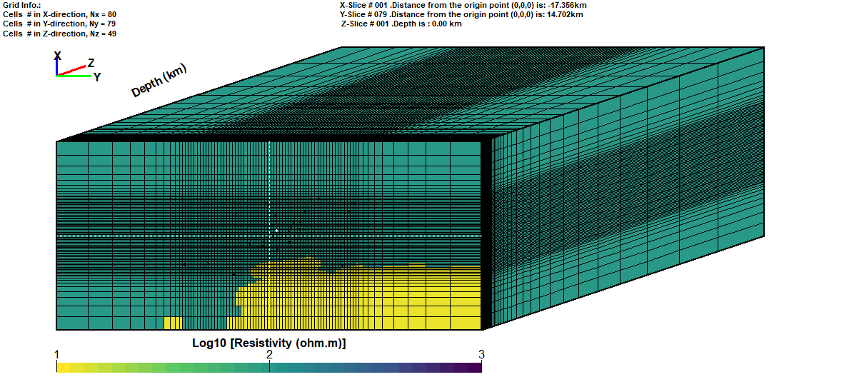 Figure 5: Starting model for a 3D inversion including bathymetry in Cornwall.
Magnetotellurics (MT) is a passive geophysical deep sounding technique using the natural variations in the earths magnetic and electric field to image the subsurface. It has many applications, from mineral exploration, geothermal reservoir characterization, monitoring volcanic hazards, subsurface injection experiments and active tectonic areas to environmental studies. At BGS the Geomagnetism capability has been using MT measurements to model ground electric fields that are caused by strong variations in the earth's magnetic field during space weather events. These geoelectric fields are driving so-called Geomagnetically Induced Currents (GIC) in grounded infrastructure and can cause damage in, e.g., high-voltage transformers.
MT theory uses the fundamental transfer function between magnetic and induced electric time-varying fields observed at the surface, called the impedance tensor Z. It contains the information about the electrical conductivity distribution of the earth from shallow (100m) to great depths in the earth's mantle, depending on the period and wavelength of the observed fields. With Z we can model images of the electrical resistivity structure of the Earth using a mathematical procedure called inversion. Using a sophisticated algorithm and the computational power of a high performance computer, we can derive fully 3D images of the subsurface.
To collect data in the field, magnetic and electric sensors are installed for a few days to several weeks. The magnetic field variations are measured using a fluxgate magnetometer (for long-period measurements) or induction coils (for broadband studies). The electric fields are captured via the potential difference between two non-polarizable electrodes. A finely tuned pre-amplifier and AC-DC converter records the data as time series with a GPS ensured time stamp.
Application to Space Weather research
At BGS, we have collected long-period MT data all over Britain under the SWIMMR-SAGE project. Fieldwork took place during many weeks in 2021-2024 in scenic locations. Because we are measuring the natural EM field, local noise from human settlements and infrastructure can be disruptive to the signal. Therefore MT sites are often in remote areas where noise sources are suspected to have minimal effect. The new data feeds into the space weather impact nowcast delivered to the MetOffice and forms the base for a whole range of research studies.
Previous space weather projects included:
Deep geothermal research
Another application of MT is in the area of exploring deep geothermal resources. Key to deep geothermal energy is an understanding of how fluids can circulate at depth, e.g., in fault zones that have higher permeability and therefore higher electrical conductivity. MT is one of only a few geophysical techniques capable at imaging depths of 2-10 km.
BGS has successfully conducted a pilot project to test the feasibility of MT in a semi-urban environment close to the Eden deep geothermal drillsite in Cornwall. We used broadband MT to investigate the electrical resistivity of the granitic intrusion down to 10 km depth. While the collected data show influence from electromagnetic noise generated by e.g. electric fences and generators, using a reference site in Bodmin moor improved overall data quality through a process called remote referencing.
Instrumentation
BGS operates the following MT data acquisition systems:- Lemi 424 long-period MT sites
- Phoenix Geophysics MTU-5C broadband systems
Contact
For more information please contact Dr Juliane Huebert.
- Global Geomagnetic Models
- Space Weather and Geomagnetic Hazard
- High-frequency magnetometers
- Schumann Resonances
- Geoelectric field monitoring
- Space Weather Impact on Ground-based Systems (SWIGS)
- SWIMMR Activities in Ground Effects (SAGE)
- Geomagnetic Virtual Observatories
- Quantum magnetometers for space weather
- Magnetotellurics
- Publications List
